Maps of Metropolis
国际大都市系列地图


Time
2019
︎2019 China’s Most Beautiful Travel Book Design CREATIVE Medal
2019第一届中国最美旅游图书设计奖 创意大奖
︎2023 Milan Design Week China Design Exhibition - Meritorious Winner
2023第七届中国高校设计学科师生优秀作品展
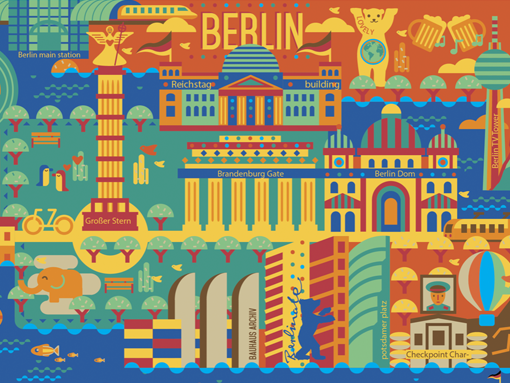
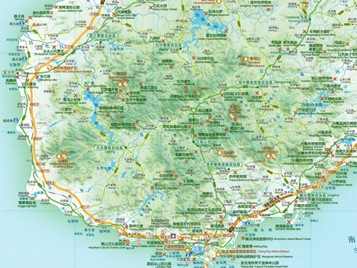
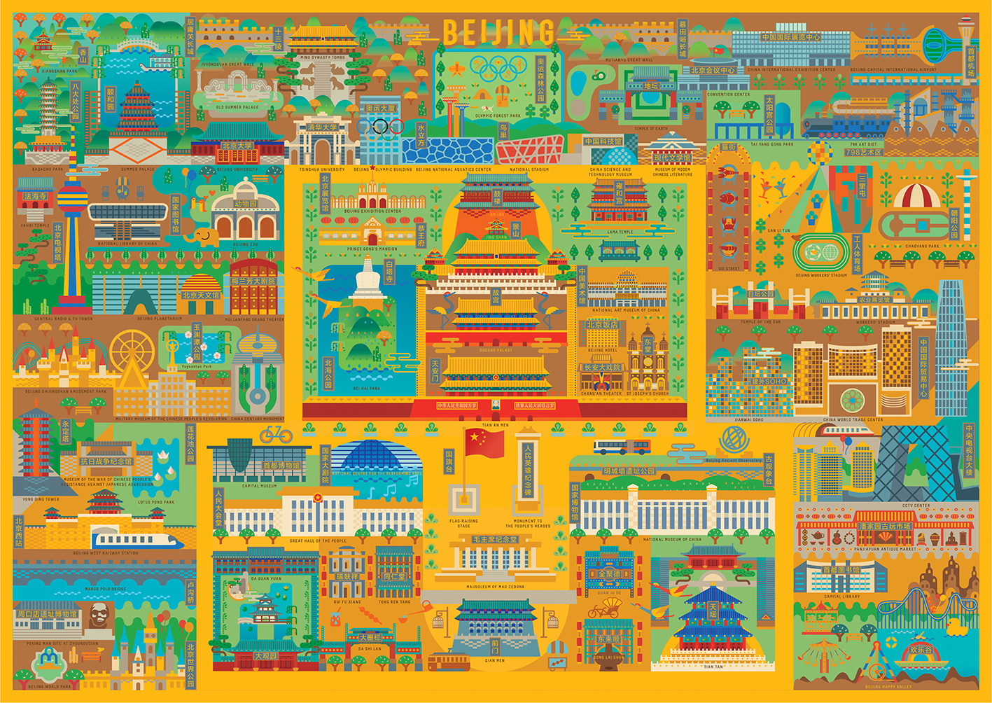
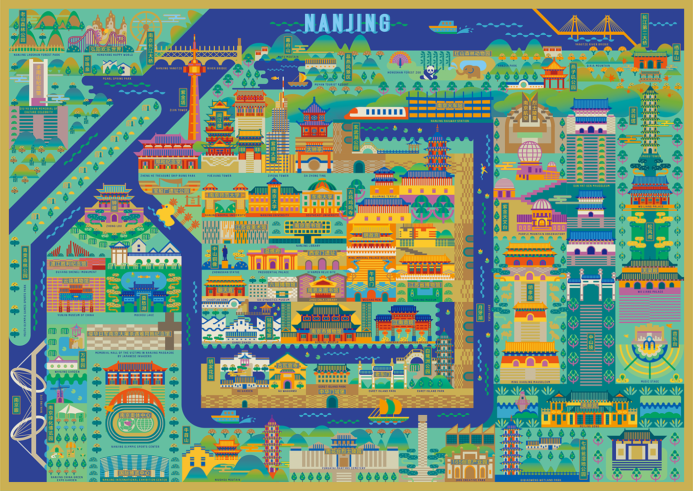
Architecture has built the city-state, bearing the civilization and national memory of a region, which is the most intuitive display of human historical changes. Maps of international metropolis trying to compose painting in various areas of the world withpicture collection, culture representative cities including Beijing, Nanjing, Chongqing, Tokyo, Paris, New York, London and other places, will be hosted in each city historical significance and distinctive architectural landmarks in a unique visual style map information into a visual, intuitive display the development characteristic of every city and urban landscape. In the end, the project will collect a huge number of urban landscapes and present the urban geographic and historical maps under various cultural backgrounds in the world in the most beautiful way. The finished map can be used as art collection, and also can be used to develop practical information map products.
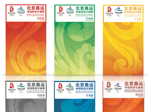
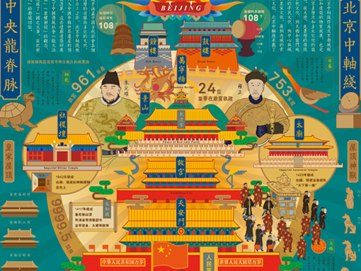
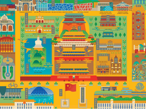
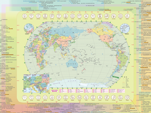
建筑构筑了城邦,承载着一个地区的文明和民族记忆,是人类历史变迁最直观的展示。"国际大都市地图集"尝试构画全世界各地区具有文化代表性的大都市景象集合,包括北京、南京、重庆、东京、巴黎、纽约、伦敦等地,将每个城市中承载历史意义和独具特色的建筑地标以独特的视觉样式绘制成一张信息视觉地图,直观展现出每一个城市的发展特点和城市风貌。项目最终会将巨量的城市图景集合起来,用最美妙的方式梳理和展示世界各文化背景下的城市地理历史图观。成品地图既可以作为艺术品收藏,也可以用作开发实用的信息地图产品。
![]()
建筑构筑了城邦,承载着一个地区的文明和民族记忆,是人类历史变迁最直观的展示。"国际大都市地图集"尝试构画全世界各地区具有文化代表性的大都市景象集合,包括北京、南京、重庆、东京、巴黎、纽约、伦敦等地,将每个城市中承载历史意义和独具特色的建筑地标以独特的视觉样式绘制成一张信息视觉地图,直观展现出每一个城市的发展特点和城市风貌。项目最终会将巨量的城市图景集合起来,用最美妙的方式梳理和展示世界各文化背景下的城市地理历史图观。成品地图既可以作为艺术品收藏,也可以用作开发实用的信息地图产品。